Surf Forecast
Jetty Surf Forecast for Week of June 16, 2026
————————————————————————
Surfline, Swellinfo etc are good for general surf forecasting, what our Jetty Surf Forecast gives you is indepth knowledge for this local area. How the tides affect the surf locally, what the water conditions are, what the sandbars are doing, what the real water temp and feel is and when has been the better times to go out. Information that the general forecast sites have no way of knowing. Updated the page below to show the relevant buoys that affect our areas and a few secret cams.
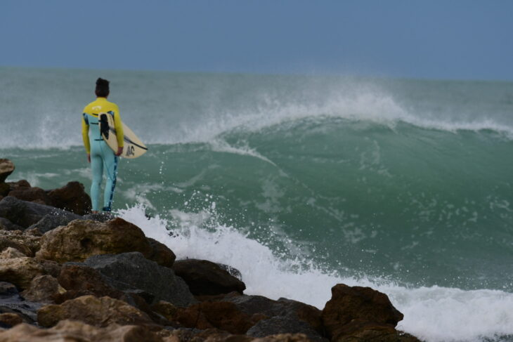
Weekly surf report: June 16 Potential tropical activity warning for north west gulf. Bringing us a small wave Thursday. North Jetty sandbar non existent so no wind protection. Maybe try the pier or south facing beaches up north for better size. Expect hopefully a thigh plus wave at best as of right now. Lower tides early and late on Thursday but get out there whenever you can. Very small waves before and after, talking barely rideable on a longboard.
June 1 We have a very very very very small wave to ride at the lower tides Monday and Tuesday but that’s about it. It is possible for a storm to form in the western gulf this time of year. So that’s something to keep an eye on. The GFS model will have a storm in the Gulf 10 days to 2 weeks out in the future then it disappears. This time of year especially start preparing when its looking likely under 5 days. East coast been looking fun here and there. Go east or go on a surf trip.
Weekly Gulf Surf Forecast:
Monday: shin to knee
Tuesday: 1 footers
Wednesday: nothing
Thursday: Go fishing
Friday: nil
Sat: Building to ankle high
Sun: Possible onshore ankle sets
*Prepare accordingly and forecast *subject to change
————————————————————————
Relevant WFLA forecast buoys
Read the buoy data. These are the buoys we use to forecast waves for West Florida, you can get the data below. When the swell and period heights elevate from the northern, western or southern buoys the waves will eventually make it to us depending on the pace of the swell.
The waves follow the wind, check long range wind forecast on Windy charts below. Check real time wind data by checking the buoys and watch the swell heights follow. There are many buoys that only record wind so check those out too by clicking the map below, “select region” will be on the top right of the map, select “Gulf of Mexico (East) Florida” then click whatever buoy your heart desires.
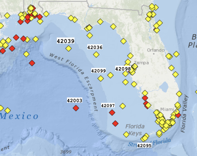 Buoy numbers above correspond to the buoys below
North Forecast buoys
42099 buoy stopped working with hurricane Idalia, back now
South forecast buoys below
42003 East Gulf – 208 NM West of Naples. Hasn’t been working for a little while but when it comes back online we’ll post it
42097 Pulley Ridge – Back online!
————————————————————————
Secret Cams
Crows Nest (Use for wind conditions sometimes)