Surf Forecast
Jetty Surf Forecast for Week of March 15, 2026
————————————————————————
Surfline, Swellinfo etc are good for general surf forecasting, what our Jetty Surf Forecast gives you is indepth knowledge for this local area. How the tides affect the surf locally, what the water conditions are, what the sandbars are doing, what the real water temp and feel is and when has been the better times to go out. Information that the general forecast sites have no way of knowing. Updated the page below to show the relevant buoys that affect our areas and a few secret cams.
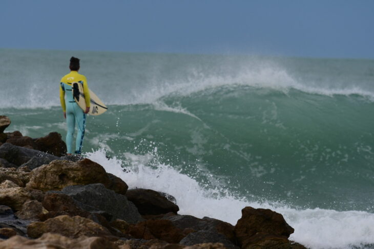
Weekly surf report: We have a mid-march front coming through early Tuesday morning. Not many fronts usually after March so take Tuesday off. At least half the day. South wind Monday. Doubt we’ll have a wave Monday as North Jetty sandbars aren’t working. Wind may with north an hour before dark leaving some jumbled swell at South Jetty but could be fun. If you want to surf Monday afternoon hit up AMI or at worst siesta. Tuesday is the day. Winds look decent all day but better early. Tide looking best from 9-12 and an hour before sunset but fun all day. Small leftovers Tuesday morning.
Weekly Gulf Surf Forecast:
Monday: Building to thigh, better at south facers
Tuesday: waist to chest high, possibly better in morning
Wednesday: small leftovers, fading
Thursday: Great weather, no waves
Friday: nil
Sat: nothing
Sun: No waves
*Prepare accordingly and forecast *subject to change
————————————————————————
Relevant WFLA forecast buoys
Read the buoy data. These are the buoys we use to forecast waves for West Florida, you can get the data below. When the swell and period heights elevate from the northern, western or southern buoys the waves will eventually make it to us depending on the pace of the swell.
The waves follow the wind, check long range wind forecast on Windy charts below. Check real time wind data by checking the buoys and watch the swell heights follow. There are many buoys that only record wind so check those out too by clicking the map below, “select region” will be on the top right of the map, select “Gulf of Mexico (East) Florida” then click whatever buoy your heart desires.
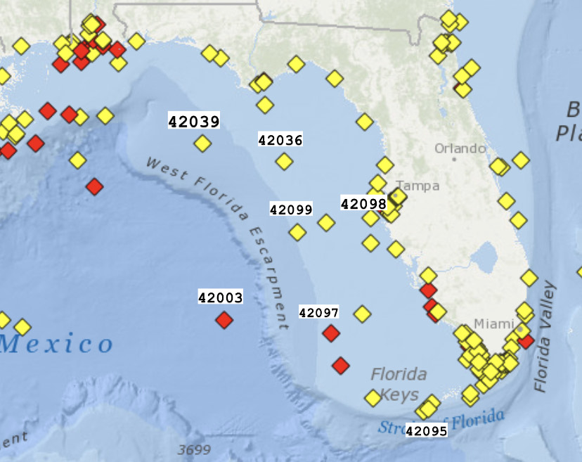 Buoy numbers above correspond to the buoys below
North Forecast buoys
42099 buoy stopped working with hurricane Idalia, back now
South forecast buoys below
42003 East Gulf – 208 NM West of Naples. Hasn’t been working for a little while but when it comes back online we’ll post it
42097 Pulley Ridge – Back online!
————————————————————————
Secret Cams
Crows Nest (Use for wind conditions sometimes)